


Traditional geofencing was built for broader needs and less precision. They provided general data around a trackers behavior in an area, but were never meant to be exact. This included oversized circular geofences or manually drawn shapes. It was static, slow, and full of errors; accuracy was always in question.
Smart geofencing is geofencing tailored toward your exact use case. If you want to know when a truck is onsite, know exactly when it is onsite, not when it's a mile away. If you want to know how many pieces of equipment are at a specific job site, know your exact count at that jobsite, and not the account for the general area. With automation and improved accuracy, geofences are created, updated, and monitored, making them faster, more reliable, and built for what you're building.
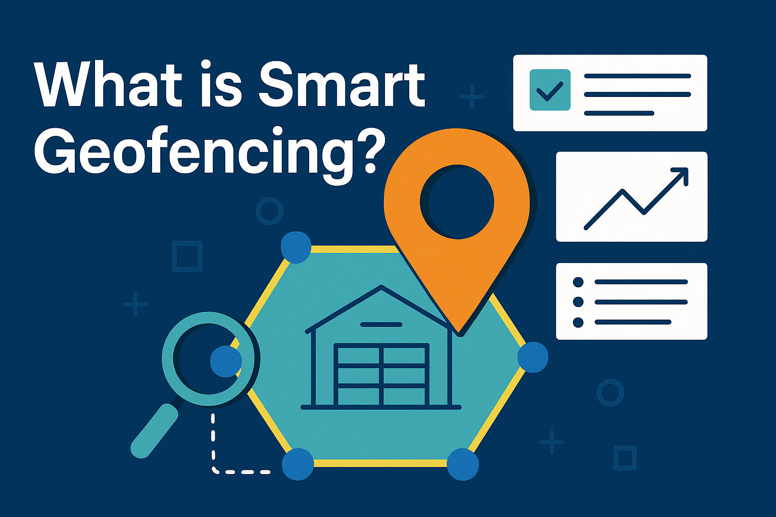
What Makes a Geofence “Smart”?
Smart geofences aren’t drawn. They’re generated based on a variety of inputs. Instead of relying on circles or guesswork, you provide an address, latitude/longitude, or point of interest, and get back a supply chain ready, QA/QC’d polygon. Kestrel coined the term Automated Geofencing because the old way is gone. No more circles. No more hand-drawing. But even that is evolving beyond just automation, and to a tailored experience.
Key features include:
- Event triggers tied to business rules: Fences act as decision-making tools, not just boundaries.
- Better data, better reports: based business decisions on the right data and information.
- Automated creation and updates: Submit location data and receive accurate polygons.
- Single source of truth: Kestrel’s geofencing database supports supply chain operations across many different platforms, even home grown or in house solutions.
Sourcing Geofences – The SMART Way!
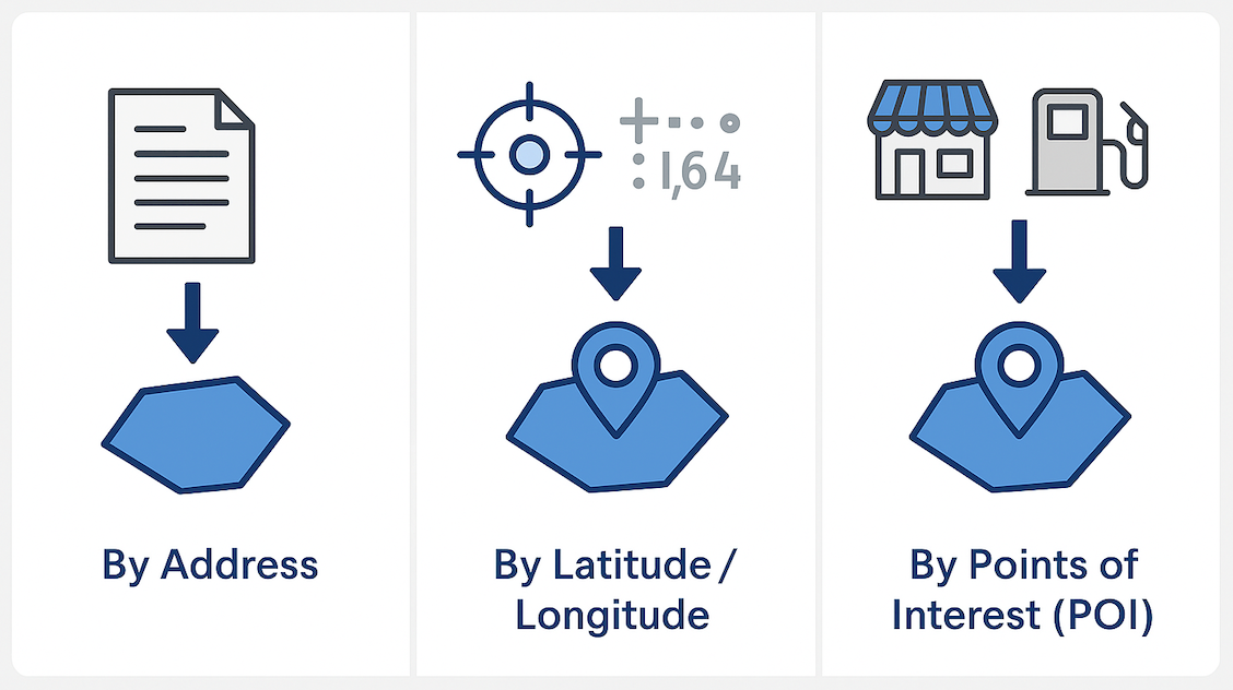
Every company's needs for geofences are different, and smart geofencing is ready for you! You can access fences quickly through multiple methods:
By Address: Import thousands of addresses at once or set up daily automated geofence creation through telematics integrations.
- “I have a list of 5,000 addresses that I need geofences for.”
- “My addresses are in Samsara with mixed circles and polygons, I need them updated to perfect polygons.”
- “My TMS creates ~20 new addresses a day; I need polygons automatically generated.”
By Latitude/Longitude: Turn raw coordinates, asset locations, or centroids into precise polygons at scale.
- “I don’t have addresses, but I’ve got lat/longs that need polygons.”
- “I need to pull asset locations from my telematics platform and build fences at scale.”
- “My centroids need to be converted into polygons.”
- “ I have a clustering report I need to create polygons for based off asset location”
By Points of Interest (POI): Pull ready-made datasets like every Home Depot in four states, every Firestone Auto Care within 150 miles of HQ, or every Walmart nationwide.
- “I need every Home Depot in Texas, Arizona, New Mexico, and Colorado.”
- “I need every Firestone Auto Care within 150 miles of HQ.”
- “I want all Walmart locations in the lower 48 states.”
Leveraging Ready-Made Databases
Why start from scratch when large datasets are readily available? Kestrel offers off-the-shelf geofence libraries for airports, seaports, distribution centers, rail terminals, weigh stations, and more. With millions of locations in the system, companies are already leveraging hundreds of thousands each month. What used to take months of manual work now takes days even hours, giving businesses the ability to launch a full-scale polygon strategy overnight.
Built-in QA/QC
Automation doesn’t just create geofences, it also ensures they’re right. Smart QA/QC detects overlaps or gaps, standardizes naming, and validates attributes. The result is a cleaner, more dependable geofence library that keeps operations running smoothly at scale.
Agnostic Placement (System Flexibility)
Smart geofences aren’t tied to just one system. They can be deployed across multiple platforms, systems, and vendors, giving businesses flexibility no matter how their operations are set up. Below are a few of the many systems that we support with a full integration today!
- Fleet management platforms – Samsara, Motive, Geotab
- Visibility and logistics tools – Project 44 and others
- Custom integration – Leverage Kestrel’s API for direct connectivity into your existing systems
This flexibility ensures geofences fit seamlessly into your workflows today while remaining future-proof as systems evolve.
Real-World Impact
The results are tangible: better data integrity, more accurate reporting, and smoother workflows. Smart geofencing takes what used to be a tedious task and turns it into a strategic advantage, helping businesses expand their vision of what’s possible. It’s automation, sourcing, QA/QC, and flexibility. By making geofences faster, more reliable, and easier to scale, businesses can unlock smarter operations and stay ready for the future.


.svg)


.svg)


.svg)

